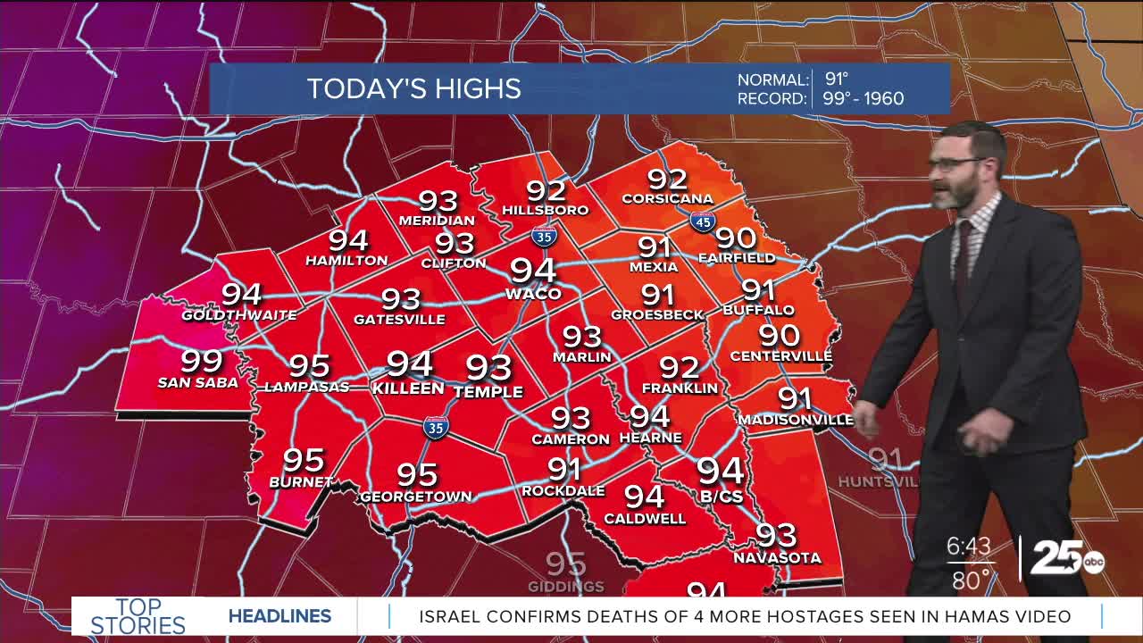
CENTRAL TEXAS — Highs will reach the mid 90s this afternoon, but humidity could send feel-like temperatures above 105 in spots. Be sure to take heat precautions. An isolated storm will be possible this evening.
THE BREAKDOWN:
- a HEAT ADVISORY is in effect for parts of Central Texas and the Brazos Valley through this evening.
- Higher than typical humidity combined with early summer-time heat will make feel like numbers reach above 105.
- An isolated storm may pop northeast of Waco this evening.
- There's also a chance a complex of storms works in overnight into the morning from DFW.
- Heat and humidity will hang around.
We're waking up to some VERY humid conditions across Central Texas this morning with dew points in the upper 70s. At the same time, summer-time heat will greet us this afternoon as high pressure aloft drifts into West Texas. The combination of heat and humidity will push feel-like temperatures above 105 in spots. Be sure to take heat precautions if you're going to be outside in the heat of the day and stay hydrated! We're keeping an eye on a dying complex of storms that may put out an outflow boundary along the I-45 corridor. This may be enough to spark a stray storm this afternoon or evening, but most miss out.
Models this morning have been fairly consistent at bringing in a complex of storms overnight into the morning from the Dallas-Fort Worth area. I don't completely buy it just yet, but the highest chances will be along and east of I-35. Don't be surprised if afternoon models bring higher storm chances overnight into the morning. The biggest threats would be gusty winds and heavy rainfall.
High pressure attempts to build east more for the second half of the week. I think that will introduce just enough sinking air to limit storm chances, pushing them east of Central Texas. Heat and humidity will still linger with feel-like numbers exceeding 105.
High pressure looks to back off to the west this weekend into early next week. That will put us under the storm track once again which means passing storms will be possible along with slightly cooler temperatures. There are even signs a cold front could come early next week, but for now I have only dropped temperatures into the low 90s.
Have a great Tuesday!
Meteorologist Josh Johns
25 Weather


